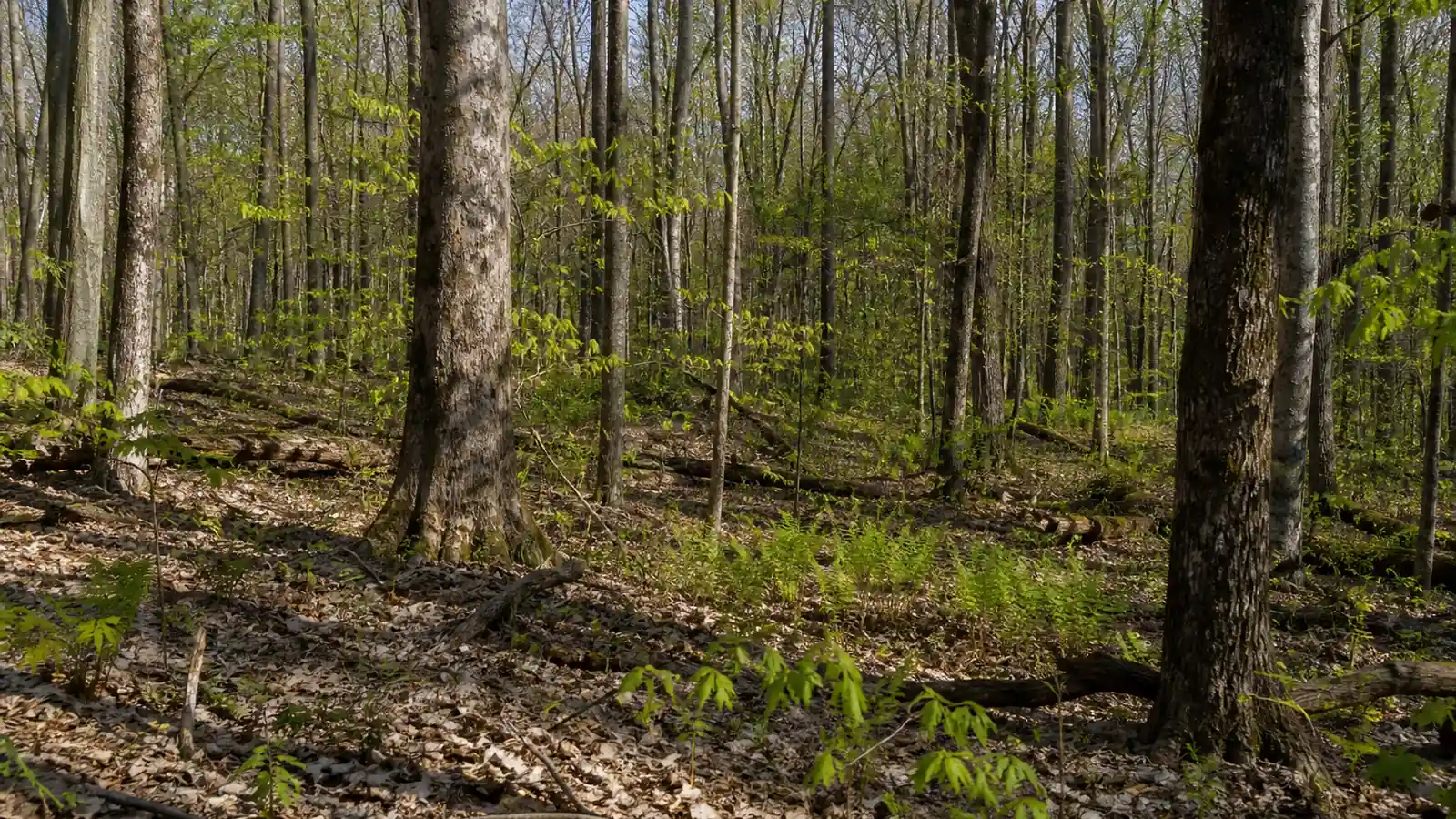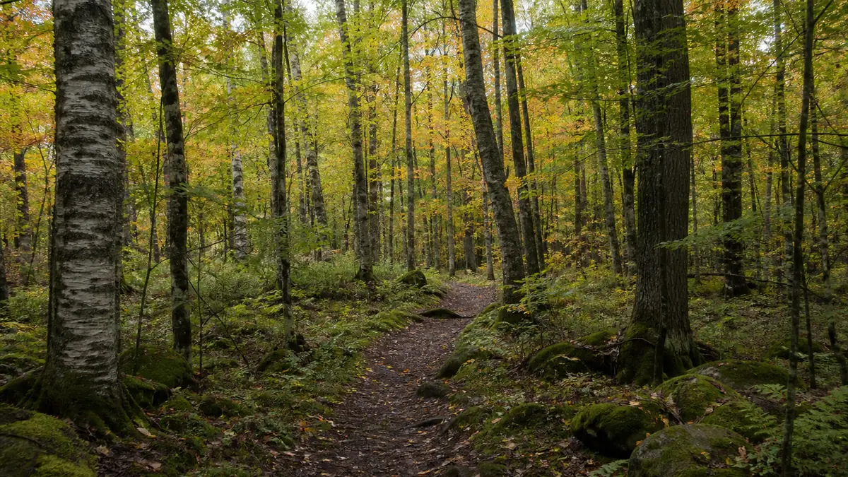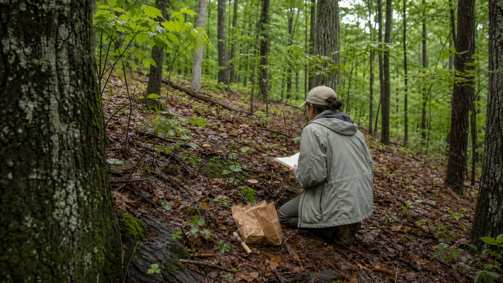
Southeast mushroom season changes across the Coastal Plain, interior uplands, and Southern Appalachians. Choose the terrain first, confirm that moisture remains in the target substrate, verify the property rule, and keep uncertain specimens separate for expert review.
Mushroom foraging in the Southeast can be productive from spring through fall, with cool-weather wood-decaying species extending the search in some areas. Humidity helps fungi, but terrain and retained moisture decide whether a particular trip makes sense.
This guide uses Virginia, West Virginia, Kentucky, Tennessee, North Carolina, South Carolina, Georgia, Florida, Alabama, Mississippi, Arkansas, and Louisiana as a practical working region. It does not claim that every agency or geographer draws the Southeast the same way.
The useful question is narrower than which month looks good.
You need to know which terrain you will enter, whether rain reached the target substrate, what trees or wood occur there, and whether the land manager permits collection.
Which Southeast terrain band are you in?
Start by placing the destination in one of three broad terrain bands. The label will not identify a mushroom, but it changes the temperature, drainage, forest type, and seasonal stage you should expect when you arrive.
The Coastal Plain runs from the Atlantic and Gulf coasts across low, warm country where sandy soil may drain quickly and bottomlands may hold water. A humid afternoon there can leave an exposed pine edge dry while a shaded hardwood seep remains wet.
The Piedmont and interior uplands add rolling ground, clay-rich soils, mixed hardwoods, reservoirs, and river systems.
This middle band often gives you several moisture conditions within a short drive, so a protected north-facing hollow can be worth checking after a ridge has dried.
The Southern Appalachians create the sharpest vertical contrast. Great Smoky Mountains National Park rises from about 850 feet to 6,643 feet, while annual rainfall ranges from roughly 55 inches in valleys to more than 85 inches on some peaks.

Use the bands to select a route rather than to rank one landscape above another.
- In the Coastal Plain, favor safely drained shade and inspect whether sandy or exposed ground has already lost the rain.
- In the Piedmont and interior uplands, compare protected hollows, creek benches, oak slopes, and deadwood instead of treating the whole property alike.
- In the Southern Appalachians, use elevation and slope aspect to redirect between a warm valley and a cooler cove or ridge.
A state can cross more than one band. Florida needs a separate tropical and subtropical reading, while Georgia and North Carolina each stretch from lower country toward mountain habitat.
That is why the state name is only the next level of detail. A state guide can narrow typical habitats and access questions, but the exact property and current conditions still control the outing.
ForagingMushroom foraging laws in France: what the five liter rule meansHow do you read the moisture window?
A rain symbol tells you that water may have fallen somewhere in the forecast area.
It does not tell you whether a brief storm penetrated the canopy, soaked the lower litter, remained in a log, or ran across compacted ground into a ditch.
Warm, wet weather often triggers visible fruiting in Georgia landscapes, according to University of Georgia Extension. The practical signal is the moisture that remains around fungal habitat after the storm, not the rainfall total by itself.
Note
A useful moisture window combines a soaking event, suitable temperature, protected substrate, and enough time for fruiting. No universal number of hours after rain works across the Southeast.
Test several points without tearing through the forest floor.

- Press below loose surface leaves and compare the lower litter with the top layer.
- Check a shaded hollow against an exposed edge to learn how quickly the site is drying.
- Feel the sheltered side of a fallen log and note whether the wood is damp or merely rain-spotted.
- Redirect after flooding because saturated trails, swift water, and unstable banks are poor search conditions.
Heat and wind can close a lowland window quickly. A mountain cove may remain cool and damp after the same weather system, while a shaded Gulf Coast bottomland may stay waterlogged rather than safely walkable.
Follow retained moisture across suitable habitat. When every test point is dry below the surface, use the visit to map trees and deadwood or wait for a more meaningful change in conditions.
When is mushroom season in the Southeast?
The Southeast has a long fungal year, but it does not have one synchronized season. Spring reaches the Gulf states and low elevations before the higher Southern Appalachians, while hard freezes return to mountain ground before much of the Coastal Plain.
- Spring
- Morels are a spring search in suitable hardwood terrain, with timing moving north and uphill as weather develops
- Summer
- Chanterelles and black trumpets become prominent warm-season targets after rain reaches shaded habitat
- Fall
- Cooling weather can broaden searches around oak bases, wounds, stumps, and fallen hardwood
- Cool periods
- Oyster mushrooms and other wood decayers can remain active beyond the main soil-mushroom window
This succession becomes useful when you turn it into four search questions.
- In spring, compare warm upland hardwoods with cooler mountain sites instead of expecting one morel week across twelve states.
- In summer, look for moisture held under hardwood canopy and learn the local chanterelle species rather than relying on orange color.
- In fall, add oak bases, trunk wounds, stumps, and fallen wood as separate repeat-visit zones.
- In mild winter weather, inspect suitable deadwood while rejecting frozen, waterlogged, or badly decayed specimens.
The tropical edge of South Florida needs its own local field knowledge because it does not share the freeze cycle of an Appalachian ridge. A regional calendar becomes least reliable where the climate boundary is largest.
These are seasonal expectations, not fixed dates.
Season and terrain tell you what question to investigate, not what answer to accept. A spring mushroom near a declining tree remains unknown until its full structure, substrate, and local lookalikes have been examined.
ForagingMushroom foraging laws in Germany: protected species and small quantitiesWhere should you walk in a Southeast forest?
Randomly scanning for colorful caps makes a large forest inefficient.
Divide the route by substrate, then follow one ecological line long enough to notice repeated tree, soil, and moisture relationships.
Soil-associated mushrooms may belong with living trees, while decomposers fruit from stumps, fallen logs, buried roots, or stressed wood. A shelf on a trunk and a vase-shaped mushroom on soil ask different identification questions even when they stand only a few yards apart.
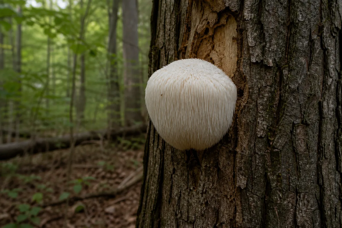
University of Georgia Extension describes wild oyster mushrooms on dead or dying hardwood. A separate Georgia observation found lion's mane at a vertical tree wound.
The trunk condition belongs in the record because it changes the substrate evidence.
Those substrate clues become four distinct searches.
- Follow intact hardwood soil for chanterelle-type mushrooms and record nearby tree species.
- Inspect oak bases and buried wood for large branching clusters.
- Scan dead and dying hardwood for oyster-like clusters and shelf fungi such as chicken of the woods.
- Check wounds and cavities for toothed fungi while leaving unreachable growth in place.
Buried roots can make a wood-decaying mushroom look as though it grew from soil. Expose only enough context to document the connection, and do not destroy a log or living tree to satisfy curiosity.
Substrate is a high-value clue, but it is never an edibility verdict. Use it to narrow the investigation and to preserve evidence for a qualified local identifier.
ForagingMushroom foraging laws in the UK: what is actually legalWhy does fast growth call for more care?
Warm wet spells can produce many fruiting bodies within a short period, and fresh color can make them look unusually convincing.
Rapid abundance also increases the chance that unrelated species will be collected together and lose their original context.
Orange mushrooms show the problem clearly. Chanterelles have blunt ridges rather than thin true gills, while jack-o'-lantern mushrooms have distinct gills and grow from wood, sometimes from roots hidden under the soil.
Warning
Never eat a wild mushroom from a regional description, a single photograph, an app result, or one matching feature. Cooking does not make every poisonous mushroom safe, and serious symptoms can be delayed.
Document the specimen before moving it.
- Photograph the whole growth in place from above, below, and from the side.
- Retain the complete stem base and show whether the mushroom is attached to soil, litter, or wood.
- Record grouping, nearby trees, bruising, odor, weather, and exact substrate.
- Use a spore print only as supporting evidence, never as a one-feature confirmation.
- Keep each unknown collection in a separate paper container with its own notes.
The orange comparison is useful because it forces attention onto structure and substrate. It does not turn every ridged orange mushroom into food, since southeastern chanterelle diversity and local lookalikes still require competent identification.
Finding, naming, and eating are three separate decisions. Stop at observation whenever the specimen is old, incomplete, mixed with another collection, or outside your current expertise.
Can you forage on public land in the Southeast?
Public access does not automatically grant a right to remove mushrooms.
National parks, national forests, state forests, wildlife areas, county parks, municipal land, and private parcels can use different rules on neighboring ground.
Great Smoky Mountains National Park provides a useful example of how specific one rule can be. Its current superintendent's compendium permits limited collection of edible fungal fruiting bodies for personal use under conditions that do not apply automatically anywhere else.
The park limits collection to one pound per person per day for all fungal species combined. It also requires collectors to remain at least 100 feet from roads and facilities, prohibits gathering within 200 feet of certain trails and study areas, and excludes fruiting bodies on standing trees or underground.
Tip
Read the current rule for the named property, not a summary for the state or agency. Save the page or office contact with the date because closures and permit conditions can change.
Complete the permission check in order.
- Identify the landowner and the exact managed unit shown on the official map.
- Find the current rule for fungi, natural products, or forest products and note any closure.
- Confirm species, quantity, zone, method, and personal-use or commercial restrictions.
- Ask the managing office when the published rule is missing or ambiguous.
A national forest office may issue a forest-product rule that differs from a nearby national park. Private land requires the owner's permission, while a public trail crossing private property does not grant collection rights beyond the easement.
Make permission the first trip filter. This saves time because a perfect moisture window cannot make an unauthorized collection acceptable.
How do you plan the 24 hours before a trip?
The night before a trip, reduce the regional forecast to one property and one terrain band. Choose the likely substrate, then prepare a clean way to keep specimens and notes separate.
1
Confirm the exact land unit, current collection rule, open areas, and any quantity or use limit
2
Compare the last several days of rain, temperature, wind, and flooding with the chosen terrain band
3
Select one primary substrate route and one legal redirect at a different elevation, aspect, or drainage position
4
Photograph each find in place with the underside, full base, attachment, nearby tree, and growth pattern visible
5
Label separate paper containers and stop collecting when field context or specimen quality is lost
6
Keep every uncertain specimen out of food and seek qualified local review before any edibility decision
That separation preserves the connection between each specimen, photograph, and habitat note.

At the trailhead, test the plan against what the site actually shows.
Dry lower litter means wait or redirect, while flooding, lightning, unsafe heat, a closure, or an unclear boundary means stop.
- Carry water, navigation, weather protection, clean paper containers, labels, a ruler, and a small brush.
- Take fewer complete specimens instead of filling a mixed basket with damaged material.
- Leave rare, immature, deteriorated, or inaccessible fruiting bodies undisturbed.
- Photograph habitat even when nothing is collected because the record improves the next route choice.
If anyone may have swallowed an unknown wild mushroom in the United States, call Poison Control immediately at 1-800-222-1222. Do not wait for symptoms, and preserve the remaining specimen, photographs, location, and time of ingestion for the poison specialists.
The procedure works because each decision has a stop condition. A productive day can end with photographs and a better habitat map when permission, moisture, specimen quality, identity, or edibility remains unresolved.
| Field evidence | Decision | Reason |
|---|---|---|
| Rule confirmed, substrate damp, safe access | Search the planned habitat | Property, conditions, and route agree |
| Planned slope dry, legal shaded hollow damp | Redirect within the property | Retained moisture supports the second route |
| Rule unclear or boundary uncertain | Stop and contact the land manager | Access cannot be inferred from the landscape |
| Specimen incomplete or mixed with another find | Document but do not eat | Required identification evidence has been lost |
| Suspected ingestion of an unknown mushroom | Call Poison Control immediately | Symptoms may be delayed and expert triage is time-sensitive |
Sources & References
- U.S. National Park Service, Great Smoky Mountains Nature and Science Regional elevation, rainfall, and habitat variation.
- U.S. National Park Service, Great Smoky Mountains Superintendent's Compendium Current property-specific mushroom collection conditions.
- University of Georgia Extension, Mushrooms of Georgia Landscapes Warm wet fruiting, Georgia diversity, oyster habitat, and safety boundary.
- Penn State Extension, Summer Phenology Notes Summer fruiting and chanterelle versus jack-o'-lantern field context.
- University of Illinois Extension, Spring Mushroom Foraging Spring morel timing and collection-rule caution.
- University of Georgia Extension, Lion's Mane Observation Lion's mane growing from a wounded Georgia tree.
- Poison Control, Wild Mushroom Warning Identification limits, delayed symptoms, cooking limits, and emergency contact.